
Mississippi–Standards of Practice for Land Surveyors: 1 PDH
$6.00
SPECIFIC KNOWLEDGE OR SKILL OBTAINED
This course teaches the following specific knowledge and skills:
- Explain the standards of practice for boundary surveys in Mississippi
- Understand the reasons for and why
- Discuss the final products of a properly performed survey
- Discuss accuracy and tolerance requirements
CERTIFICATE OF COMPLETION
You will be able to immediately print a certificate of completion after passing a 10 question multiple-choice quiz. The quiz can be retaken unlimited times until a passing grade of 70% or better is earned. This course satisfies three professional development hours (PDH) of continuing education.
Related Courses
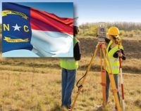
North Carolina–Standards of Practice for Land Surveying: 1 PDH
$6.00 Add to cartIn this course the student will review and examine the standards of practice for land surveying in North Carolina and satisfy the one hour of continuing education required by the 21 NCAC 56.1703.Instructor: Raymond Bosek, PESPECIFIC KNOWLEDGE OR SKILL OBTAINED
This course teaches the following specific knowledge and skills:
- Explain the standards of practice for boundary surveys in North Carolina
- Understand the reasons for and why
- Discuss the final products of a properly performed survey
- Discuss accuracy and tolerance requirements
CERTIFICATE OF COMPLETION
You will be able to immediately print a certificate of completion after passing a ten (10) question multiple-choice quiz. The quiz can be retaken unlimited times until a passing grade of 70% or better is earned. This course satisfies one (1) professional development hour (PDH) of continuing education.
Preview CourseClick “Preview Course” to View Prior to PurchaseClick “Add to Cart” to Purchase and Access Quiz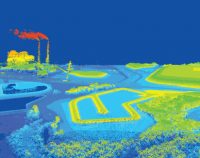
Airborne Topographic LiDAR: 3 PDH
$18.00 Add to cartIn this course the student will review the principles of Airborne Topographic LiDAR and learn how to utilize methods to employ this technology in the field.Instructor: Raymond Bosek, PESPECIFIC KNOWLEDGE OR SKILL OBTAINED
This course teaches the following specific knowledge and skills:
- Explain what Airborne Topographic LiDAR is
- Understand the principles and methods of operation
- Discuss overall planning concepts
- Discuss LiDAR data processing and report generation
CERTIFICATE OF COMPLETION
You will be able to immediately print a certificate of completion after passing a 10 question multiple-choice quiz. The quiz can be retaken unlimited times until a passing grade of 70% or better is earned. This course satisfies three professional development hours (PDH) of continuing education.
Preview CourseClick “Preview Course” to View Prior to PurchaseClick “Add to Cart” to Purchase and Access Quiz

