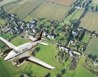
Aerial Photogrammetry: 5 PDH
$30.00 Add to cartIn this course the student will understand procedural guidance, technical specifications, and quality control (QC) criteria for performing aerial photogrammetric mapping activities.Instructor: Raymond Bosek, PESPECIFIC KNOWLEDGE OR SKILL OBTAINED
This course teaches the following specific knowledge and skills:
- Discuss the fundamentals & principles of aerial photogrammetry
- Explain photographic scale, geometry and coordinate system equations
- Discuss operational procedures and standards
- Discuss all aspects of planning
- Explain aerial image acquisition & aerial triangulation
- Understand digital photogrammetric mapping workflow
CERTIFICATE OF COMPLETION
You will be able to immediately print a certificate of completion after passing a 20 question multiple-choice quiz. The quiz can be retaken unlimited times until a passing grade of 70% or better is earned. This course satisfies five professional development hours (PDH) of continuing education.
Preview CourseClick “Preview Course” to View Prior to PurchaseClick “Add to Cart” to Purchase and Access Quiz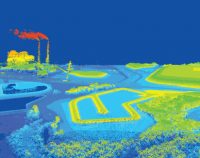
Airborne Topographic LiDAR: 3 PDH
$18.00 Add to cartIn this course the student will review the principles of Airborne Topographic LiDAR and learn how to utilize methods to employ this technology in the field.Instructor: Raymond Bosek, PESPECIFIC KNOWLEDGE OR SKILL OBTAINED
This course teaches the following specific knowledge and skills:
- Explain what Airborne Topographic LiDAR is
- Understand the principles and methods of operation
- Discuss overall planning concepts
- Discuss LiDAR data processing and report generation
CERTIFICATE OF COMPLETION
You will be able to immediately print a certificate of completion after passing a 10 question multiple-choice quiz. The quiz can be retaken unlimited times until a passing grade of 70% or better is earned. This course satisfies three professional development hours (PDH) of continuing education.
Preview CourseClick “Preview Course” to View Prior to PurchaseClick “Add to Cart” to Purchase and Access Quiz
Alabama–Standards of Practice for Land Surveying: 4 PDH
$24.00 Add to cartIn this course the student will review and examine the standards of practice for land surveying in Alabama and satisfy the four (4) hours of continuing education required by The Code of Alabama Sec. 34-11-6(f).Instructor: Raymond Bosek, PESPECIFIC KNOWLEDGE OR SKILL OBTAINED
This course teaches the following specific knowledge and skills:
- Explain the standards of practice for boundary surveys in Alabama
- Understand the reasons for and why
- Discuss the final products of a properly performed survey
- Discuss accuracy and tolerance requirements
CERTIFICATE OF COMPLETION
You will be able to immediately print a certificate of completion after passing a ten (10) question multiple-choice quiz. The quiz can be retaken unlimited times until a passing grade of 70% or better is earned. This course satisfies four (4) professional development hours (PDH) of continuing education.
Preview Course
Click “Preview Course” to View Prior to Purchase
Click “Add to Cart” to Purchase and Access Quiz
Concrete Construction: 6 PDH
$36.00 Add to cartMore concrete is used than any other man-made material in the world, about seven billion cubic meters of concrete – more than one cubic meter for every person on Earth.
Concrete is one of the most important construction materials. It is comparatively economical, easy to make, offers continuity and solidity, and will bond with other materials.
In this course the student will understand essentially all aspects of concrete construction including characteristics, mix design, formwork, joints, placement, finishing, and pre-cast. Instructor: Raymond Bosek, PESPECIFIC KNOWLEDGE OR SKILL OBTAINED
This course teaches the following specific knowledge and skills:
- Define characteristics of concrete
- Identify ingredients essential for good concrete
- Calculate concrete mix designs
- Determine methods and mixing times of concrete
- Describe the types of concrete forms and their construction
- Determine the types of ties for and placement of reinforcing steel
- Determine the location of construction joints
- Determine proper occasions for using the concrete saw
- Describe the proper procedures for placing concrete
- Describe the methods available for consolidating concrete
- Describe the finishing process for the final concrete surface
- Determine projects suitable for and lifting methods necessary for precast and tilt-up construction
CERTIFICATE OF COMPLETION
You will be able to immediately print a certificate of completion after passing a 21 question multiple-choice quiz. The quiz can be retaken unlimited times until a passing grade of 70% or better is earned. This course satisfies six professional development hours (PDH) of continuing education.
Preview CourseClick “Preview Course” to View Prior to PurchaseClick “Add to Cart” to Purchase and Access Quiz
Construction Surveying Curves: 3 PDH
$18.00 Add to cartIn this course the student will learns to locate points using angles and distances for establishing curves. An essential tool in construction surveying when determining the line of a curve for road layout or some other type of curved construction.Instructor: Raymond Bosek, PESPECIFIC KNOWLEDGE OR SKILL OBTAINED
This course teaches the following specific knowledge and skills:
- Understand & calculate simple horizontal curves
- Explain obstacles to curve locations
- Calculate & discuss Compound and Reverse Curves
- Explain & calculate Transition Spirals
- Discuss & calculate Vertical Curves
CERTIFICATE OF COMPLETION
You will be able to immediately print a certificate of completion after passing a 10 question multiple-choice quiz. The quiz can be retaken unlimited times until a passing grade of 70% or better is earned. This course satisfies three (3) professional development hours (PDH) of continuing education.
Preview CourseClick “Preview Course” to View Prior to PurchaseClick “Add to Cart” to Purchase and Access Quiz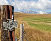
Corner Restoration Fundamentals: 2 PDH
$12.00 Add to cartIn this course the student will understand the understand federal guidelines of resurveying corner monuments and the procedures and laws to successfully reestablish these boundaries.Instructor: Raymond Bosek, PESPECIFIC KNOWLEDGE OR SKILL OBTAINED
This course teaches the following specific knowledge and skills:
- Explain proportionment problems and methods
- Discuss Property rights and boundaries
- Understand and explain water boundaries
- Discuss non-conventional Cadastral survey
CERTIFICATE OF COMPLETION
You will be able to immediately print a certificate of completion after passing a 10 question multiple-choice quiz. The quiz can be retaken unlimited times until a passing grade of 70% or better is earned. This course satisfies two (2) professional development hours (PDH) of continuing education.
Preview CourseClick “Preview Course” to View Prior to PurchaseClick “Add to Cart” to Purchase and Access Quiz
Description of Lands: 3 PDH
$18.00 Add to cartThis course provides guidance for documenting accurate boundary descriptions and locations by survey in the standards followed for Executive and public land orders and proclamations.Instructor: Raymond Bosek, PESPECIFIC KNOWLEDGE OR SKILL OBTAINED
This course teaches the following specific knowledge and skills:
- Discuss land descriptions
- Explain the public land survey system
- Discuss metes-and-bounds surveys
- Discuss lot and block descriptions
- Explain illustrations and coordinates
- Understand form and arrangement
CERTIFICATE OF COMPLETION
You will be able to immediately print a certificate of completion after passing a 10 question multiple-choice quiz. The quiz can be retaken unlimited times until a passing grade of 70% or better is earned. This course satisfies three (3) professional development hours (PDH) of continuing education.
Preview CourseClick “Preview Course” to View Prior to PurchaseClick “Add to Cart” to Purchase and Access Quiz
Introduction to Small Unmanned Aircraft Systems (sUAS) for Land Surveyors : 4 PDH
$24.00 Add to cartThis course is an introduction of using sUAS in land surveying. From FAA licensing requirements to common sUAS products and software, with an understanding of these basics a land surveyor can easily get started in using this up and coming technology.Instructor: Raymond Bosek, PESPECIFIC KNOWLEDGE OR SKILL OBTAINED
This course teaches the following specific knowledge and skills:
- Describe how sUAS will decrease costs and increase accuracy for land surveying
- Explain important FAA regulations in operating sUAS for land surveying
- Discuss sUAS operations for accuracy and repeatability
- Describe the various equipment and sensors commercially available today
CERTIFICATE OF COMPLETION
You will be able to immediately print a certificate of completion after passing a 20 question multiple-choice quiz. The quiz can be retaken unlimited times until a passing grade of 70% or better is earned. This course satisfies four (4) professional development hours (PDH) of continuing education.
Preview CourseClick “Preview Course” to View Prior to PurchaseClick “Add to Cart” to Purchase and Access Quiz
Land Surveyor’s Ethics: 2 PDH
$12.00 Add to cartIn this ethics course the student will understand the standards of professional behavior for adherence to the highest ethical conduct and revisit the emphasis that the holder of a professional license has a direct and vital impact on the safety, health, and welfare of the public.Instructor: Raymond Bosek, PESPECIFIC KNOWLEDGE OR SKILL OBTAINED
This course teaches the following specific knowledge and skills:
- Describe the value of being a Professional and discuss the various aspects of professionalism
- Understand the responsibilities of being a professional land surveyor
- Discuss ethical principles and codes of conduct including the land surveyor’s ethics creed and cannons
- Discuss the nine aspects of the principles of land surveyor ethics
CERTIFICATE OF COMPLETION
You will be able to immediately print a certificate of completion after passing a 10 question multiple-choice quiz. The quiz can be retaken unlimited times until a passing grade of 70% or better is earned. This course satisfies two professional development hours (PDH) of continuing education.
Preview CourseClick “Preview Course” to View Prior to PurchaseClick “Add to Cart” to Purchase and Access Quiz
Louisiana – Standards of Practice for Boundary Surveys: 2 PDH
$12.00 Add to cartIn this course the student will review and examine the standards of practice for boundary surveys standards in Louisiana and satisfy the two required hours of continuing education required by the L.A.C. §3105 (2).Instructor: Raymond Bosek, PESPECIFIC KNOWLEDGE OR SKILL OBTAINED
This course teaches the following specific knowledge and skills:
- Explain the standards of practice for boundary surveys in Louisiana
- Understand the reasons for and why
- Discuss the final products of a properly performed survey
- Discuss accuracy and tolerance requirements
CERTIFICATE OF COMPLETION
You will be able to immediately print a certificate of completion after passing a 20 question multiple-choice quiz. The quiz can be retaken unlimited times until a passing grade of 70% or better is earned. This course satisfies three professional development hours (PDH) of continuing education.
Preview CourseClick “Preview Course” to View Prior to PurchaseClick “Add to Cart” to Purchase and Access Quiz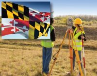
Maryland–Minimum Standards of Practice & Ethics: 4 PDH
$24.00 Add to cartIn this course the student will review and examine both the minimum standards of practice for boundary surveys in Maryland as well Ethics to satisfy the four mandatory hours of continuing education required by the COMAR. §09.13.08.03.Instructor: Raymond Bosek, PESPECIFIC KNOWLEDGE OR SKILL OBTAINED
This course teaches the following specific knowledge and skills:
- Explain the standards of practice for boundary surveys in Maryland
- Understand the reasons for and why
- Discuss the final products of a properly performed survey
- Discuss accuracy and tolerance requirements
- Describe the value of being a Professional and discuss the various aspects of professionalism
- Understand the responsibilities of being a professional land surveyor
- Discuss ethical principles and codes of conduct including the land surveyor’s ethics creed and cannons
- Discuss the nine aspects of the principles of land surveyor ethics
CERTIFICATE OF COMPLETION
You will be able to immediately print a certificate of completion after passing a 20 question multiple-choice quiz. The quiz can be retaken unlimited times until a passing grade of 70% or better is earned. This course satisfies four (4) professional development hours (PDH) of continuing education.
Preview CourseClick “Preview Course” to View Prior to PurchaseClick “Add to Cart” to Purchase and Access Quiz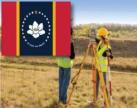
Mississippi–Standards of Practice for Land Surveyors: 1 PDH
$6.00 Add to cartIn this course the student will review and examine the standards of practice for boundary surveys standards in Mississippi and satisfy the one hour of continuing education required by the M.A.C. §Title 30, Part 901 Rule 23.1 (3).Instructor: Raymond Bosek, PESPECIFIC KNOWLEDGE OR SKILL OBTAINED
This course teaches the following specific knowledge and skills:
- Explain the standards of practice for boundary surveys in Mississippi
- Understand the reasons for and why
- Discuss the final products of a properly performed survey
- Discuss accuracy and tolerance requirements
CERTIFICATE OF COMPLETION
You will be able to immediately print a certificate of completion after passing a 10 question multiple-choice quiz. The quiz can be retaken unlimited times until a passing grade of 70% or better is earned. This course satisfies three professional development hours (PDH) of continuing education.
Preview CourseClick “Preview Course” to View Prior to PurchaseClick “Add to Cart” to Purchase and Access Quiz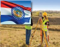
Missouri Surveying Standards: 2 PDH
$12.00 Add to cartIn this course the student will review and examine the standards of practice for land surveying in Missouri and satisfy the two (2) hours of continuing education required by Missouri Code of State Regulations 20 CSR 2030-8.020(1)(A).Instructor: Raymond Bosek, PESPECIFIC KNOWLEDGE OR SKILL OBTAINED
This course teaches the following specific knowledge and skills:
- Explain the standards of practice for boundary surveys in Missouri
- Understand the reasons for and why
- Discuss the final products of a properly performed survey
- Discuss accuracy and tolerance requirements
CERTIFICATE OF COMPLETION
You will be able to immediately print a certificate of completion after passing a ten (10) question multiple-choice quiz. The quiz can be retaken unlimited times until a passing grade of 70% or better is earned. This course satisfies two (2) professional development hours (PDH) of continuing education.
Preview CourseClick “Preview Course” to View Prior to PurchaseClick “Add to Cart” to Purchase and Access Quiz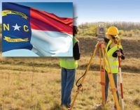
North Carolina–Standards of Practice for Land Surveying: 1 PDH
$6.00 Add to cartIn this course the student will review and examine the standards of practice for land surveying in North Carolina and satisfy the one hour of continuing education required by the 21 NCAC 56.1703.Instructor: Raymond Bosek, PESPECIFIC KNOWLEDGE OR SKILL OBTAINED
This course teaches the following specific knowledge and skills:
- Explain the standards of practice for boundary surveys in North Carolina
- Understand the reasons for and why
- Discuss the final products of a properly performed survey
- Discuss accuracy and tolerance requirements
CERTIFICATE OF COMPLETION
You will be able to immediately print a certificate of completion after passing a ten (10) question multiple-choice quiz. The quiz can be retaken unlimited times until a passing grade of 70% or better is earned. This course satisfies one (1) professional development hour (PDH) of continuing education.
Preview CourseClick “Preview Course” to View Prior to PurchaseClick “Add to Cart” to Purchase and Access Quiz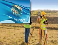
Oklahoma Minimum Standards for the Practice of Land Surveying: 2 PDH
$12.00 Add to cartIn this course the student will review and examine with the standards of practice for land surveying in Oklahoma and satisfy the two hours of continuing education required by the O.A.C. §245:15-11-5.Instructor: Raymond Bosek, PESPECIFIC KNOWLEDGE OR SKILL OBTAINED
This course teaches the following specific knowledge and skills:
- Explain the standards of practice for boundary surveys in Oklahoma
- Understand the reasons for and why
- Discuss the final products of a properly performed survey
- Discuss accuracy and tolerance requirements
CERTIFICATE OF COMPLETION
You will be able to immediately print a certificate of completion after passing a ten (10) question multiple-choice quiz. The quiz can be retaken unlimited times until a passing grade of 70% or better is earned. This course satisfies two (2) professional development hours (PDH) of continuing education.
Preview CourseClick “Preview Course” to View Prior to PurchaseClick “Add to Cart” to Purchase and Access Quiz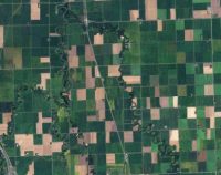
Public Land Survey: Rectangular System: 8 PDH
$40.00 Add to cartIn this course the student will review the rectangular surveying system which has been used continuously in the United States since 1785. As all facets of this system occasionally come into use, the student will become well versed in the field procedures of conducting an original survey covering both historical and current methods.Instructor: Raymond Bosek, PESPECIFIC KNOWLEDGE OR SKILL OBTAINED
This course teaches the following specific knowledge and skills:
- Explain the general scheme of the rectangular system: points, meridian, base lines, parallels, etc.
- Understand township boundaries
- Discuss subdivision of townships
- Discuss extension and completion surveys
- Explain methods of section subdivision
- Discuss protraction diagrams and developing amended diagrams
- Explain methods of surveying amended protraction diagrams
- Discuss meandering & swamp/overflowed lands
- Discuss limits of closure for original survey & soil classification
- Understand legal settings of Ordinary High Water Mark (OHWM)
CERTIFICATE OF COMPLETION
You will be able to immediately print a certificate of completion after passing a 25 question multiple-choice quiz. The quiz can be retaken unlimited times until a passing grade of 70% or better is earned. This course satisfies eight professional development hours (PDH) of continuing education.
Preview CourseClick “Preview Course” to View Prior to PurchaseClick “Add to Cart” to Purchase and Access Quiz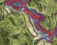
Remote Sensing Essentials: 5 PDH
$30.00 Add to cartIn this course the student will understand the theory and practice of remote sensing and image processing. Remote sensing is valuable tool for engineers and surveyors as it provides a cost-effective means of surveying, monitoring, and mapping objects at or near the surface of the Earth.Instructor: Raymond Bosek, PESPECIFIC KNOWLEDGE OR SKILL OBTAINED
This course teaches the following specific knowledge and skills:
- Explain remote sensing and its applications
- Discuss the basic components of remote sensing
- Discuss the history and future of remote sensing
- Understand three-dimensional (3d) data acquisition
- Describe elements of processing geospatial data
- Explain image enhancements
- Explain Digital Elevation Models (DEMs)
CERTIFICATE OF COMPLETION
You will be able to immediately print a certificate of completion after passing a 20 question multiple-choice quiz. The quiz can be retaken unlimited times until a passing grade of 70% or better is earned. This course satisfies five (5) hours of professional development (PDH).
Preview CourseClick “Preview Course” to view prior to purchaseClick “Add to Cart” to purchase
Satellite Photogrammetry: 2 PDH
$12.00 Add to cartIn this course the student will learn about satellite photogrammetry and its commom applications. The student will review geo-positioning from satellite images and procedures for creating stereo pairs from satellite imagery as well as reviewing the top things to consider in buying optical satellite imagery.Instructor: Raymond Bosek, PESPECIFIC KNOWLEDGE OR SKILL OBTAINED
This course teaches the following specific knowledge and skills:
- Explain the characteristics of the most popular high- and medium-resolution commercial imaging satellites
- Discuss planimetric, classification, and topographic mapping
- Discuss geo-positioning and convergence angles
- Discuss what to consider in buying optical satellite imagery
CERTIFICATE OF COMPLETION
You will be able to immediately print a certificate of completion after passing a 10 question multiple-choice quiz. The quiz can be retaken unlimited times until a passing grade of 70% or better is earned. This course satisfies two professional development hours (PDH) of continuing education.
Preview CourseClick “Preview Course” to View Prior to PurchaseClick “Add to Cart” to Purchase and Access Quiz
Site Work Basics: 4 PDH
$24.00 Add to cartIn this course the student will understand the concepts of construction site preparations. This course will offer an essential overview of site surveys, earthwork operations, common equipment and uses, as well as permitting. Instructor: Raymond Bosek, PESPECIFIC KNOWLEDGE OR SKILL OBTAINED
This course teaches the following specific knowledge and skills:
- Explain types of site surveys and their components, including construction surveys, bench marks, datum, and mean sea level
- Explain types of earthwork operations, including pioneering, grubbing, stripping, and drainage
- Describe types of leveling instruments and their uses
- Interpret readings from a leveling rod
- Determine elevations in the field to locate points at specified elevations
- Determine boundaries of building layout
- Determine classes of soils through soils testing
- Determine soil stabilization strategies
CERTIFICATE OF COMPLETION
You will be able to immediately print a certificate of completion after passing a 20 question multiple-choice quiz. The quiz can be retaken unlimited times until a passing grade of 70% or better is earned. This course satisfies four professional development hours (PDH) of continuing education.
Preview CourseClick “Preview Course” to View Prior to PurchaseClick “Add to Cart” to Purchase and Access Quiz
Illinois – Statutes and Rules for Professional Land Surveyors: 4 PDH
$24.00 Add to cartIn this course the student will study the State Board of Professional Land Surveyors of the Illinois Department of Financial and Professional Regulation Statutes and Rules. A ten (10) question quiz will test his or her understanding of the subject.Instructor: Raymond Bosek, PESPECIFIC KNOWLEDGE OR SKILL OBTAINED
This course teaches the following specific knowledge and skills:
- The land surveyor’s guidelines for practicing within Illinois's statutes and rules
- Explain the standards of practice for boundary surveys in Louisiana
- Understand the reasons for and why
- Discuss the final products of a properly performed survey
- Discuss accuracy and tolerance requirements
- The and surveyor’s responsibility to the profession
CERTIFICATE OF COMPLETION
You will be able to immediately print a certificate of completion after passing a ten (10) question multiple-choice quiz. The quiz can be retaken unlimited times until a passing grade of 70% or better is earned. This course satisfies four (4) professional development hours (PDH) of continuing education.
Preview CourseClick “Preview Course” to view prior to purchaseClick “Add to Cart” to purchase


Shopping Cart