- Sale!
Alabama-Land Surveyors Package: 30 PDH
Original price was: $180.00.$90.00Current price is: $90.00. Add to cartEight Land Surveying courses courses that will earn 30 PDH guaranteed to be accepted by the Alabama State Board of Licensure for Professional Engineers and Land SurveyorsInstructor: Raymond Bosek, PELand Surveyor’s Ethics: 2 PDH
In this ethics course the student will understand the standards of professional behavior for adherence to the highest ethical conduct and revisit the emphasis that the holder of a professional license has a direct and vital impact on the safety, health, and welfare of the public.
Alabama–Standards of Practice for Land Surveying: 4 PDH
In this course the student will review and examine the standards of practice for land surveying in Alabama and satisfy the four (4) hours of continuing education required by The Code of Alabama Sec. 34-11-6(f).
Public Land Survey Rectangular System: 8 PDH
In this course the student will review the rectangular surveying system which has been used continuously in the United States since 1785. As all facets of this system occasionally come into use, the student will become well versed in the field procedures of conducting an original survey covering both historical and current methods.
Aerial Photogrammetry: 5 PDH
In this course the student will understand procedural guidance, technical specifications, and quality control (QC) criteria for performing aerial photogrammetric mapping activities.
Airborne Topographic LiDAR: 3 PDH
In this course the student will review the principles of Airborne Topographic LiDAR and learn how to utilize methods to employ this technology in the field.
Construction Surveying Curves: 3 PDH
In this course the student will learns to locate points using angles and distances for establishing curves. An essential tool in construction surveying when determining the line of a curve for road layout or some other type of curved construction.
Description of Lands: 3 PDH
This course provides guidance for documenting accurate boundary descriptions and locations by survey in the standards followed for Executive and public land orders and proclamations.
Corner Restoration Fundamentals: 2 PDH
In this course the student will understand the understand federal guidelines of resurveying corner monuments and the procedures and laws to successfully reestablish these boundaries.
Preview Course: Land Surveyor’s Ethics
Preview Course: Alabama Standards of Practice for Land Surveying
Preview Course: Public Land Survey: Rectangular System
Preview Course: Aerial Photogrammetry
Preview Course: Airborne Topographic LiDAR
Preview Course: Construction Surveying Curves
Preview Course: Description of Lands
Preview Course: Corner Restoration Fundamentals - Sale!
Alaska-Land Surveyors Package: 24 PDH
Original price was: $144.00.$80.00Current price is: $80.00. Add to cartSix Land Surveying courses courses that will earn 24 PDH guaranteed to be accepted by the Alaska State Board of Professional Engineers, Land Surveyors, and GeologistsInstructor: Raymond Bosek, PELand Surveyor’s Ethics: 2 PDH
In this ethics course the student will understand the standards of professional behavior for adherence to the highest ethical conduct and revisit the emphasis that the holder of a professional license has a direct and vital impact on the safety, health, and welfare of the public.
Public Land Survey Rectangular System: 8 PDH
In this course the student will review the rectangular surveying system which has been used continuously in the United States since 1785. As all facets of this system occasionally come into use, the student will become well versed in the field procedures of conducting an original survey covering both historical and current methods.
Aerial Photogrammetry: 5 PDH
In this course the student will understand procedural guidance, technical specifications, and quality control (QC) criteria for performing aerial photogrammetric mapping activities.
Introduction to Small Unmanned Aircraft Systems (sUAS) for Land Surveyors: 4 PDH
This course is an introduction of using sUAS in land surveying. From FAA licensing requirements to common sUAS products and software, with an understanding of these basics a land surveyor can easily get started in using this up and coming technology.
Airborne Topographic LiDAR: 3 PDH
In this course the student will review the principles of Airborne Topographic LiDAR and learn how to utilize methods to employ this technology in the field.
Corner Restoration Fundamentals: 2 PDH
In this course the student will understand the understand federal guidelines of resurveying corner monuments and the procedures and laws to successfully reestablish these boundaries.
Preview Course: Land Surveyor’s Ethics
Preview Course: Public Land Survey: Rectangular System
Preview Course: Aerial Photogrammetry
Preview Course: Introduction to Small Unmanned Aircraft Systems (sUAS) for Land Surveyors
Preview Course: Airborne Topographic LiDAR
Preview Course: Corner Restoration Fundamentals - Sale!
Arkansas-Land Surveyors Package: 30 PDH
Original price was: $180.00.$90.00Current price is: $90.00. Add to cartEight Land Surveying courses courses that will earn 30 PDH guaranteed to be accepted by the Arkansas State Board of Licensure for Professional Engineers and Professional Land Surveyors. Instructor: Raymond Bosek, PELand Surveyor’s Ethics: 2 PDH
In this ethics course the student will understand the standards of professional behavior for adherence to the highest ethical conduct and revisit the emphasis that the holder of a professional license has a direct and vital impact on the safety, health, and welfare of the public.
Public Land Survey Rectangular System: 8 PDH
In this course the student will review the rectangular surveying system which has been used continuously in the United States since 1785. As all facets of this system occasionally come into use, the student will become well versed in the field procedures of conducting an original survey covering both historical and current methods.
Aerial Photogrammetry: 5 PDH
In this course the student will understand procedural guidance, technical specifications, and quality control (QC) criteria for performing aerial photogrammetric mapping activities.
Introduction to Small Unmanned Aircraft Systems (sUAS) for Land Surveyors: 4 PDH
This course is an introduction of using sUAS in land surveying. From FAA licensing requirements to common sUAS products and software, with an understanding of these basics a land surveyor can easily get started in using this up and coming technology.
Airborne Topographic LiDAR: 3 PDH
In this course the student will review the principles of Airborne Topographic LiDAR and learn how to utilize methods to employ this technology in the field.
Construction Surveying Curves: 3 PDH
In this course the student will learns to locate points using angles and distances for establishing curves. An essential tool in construction surveying when determining the line of a curve for road layout or some other type of curved construction.
Description of Lands: 3 PDH
This course provides guidance for documenting accurate boundary descriptions and locations by survey in the standards followed for Executive and public land orders and proclamations.
Corner Restoration Fundamentals: 2 PDH
In this course the student will understand the understand federal guidelines of resurveying corner monuments and the procedures and laws to successfully reestablish these boundaries.
Preview Course: Land Surveyor’s Ethics
Preview Course: Public Land Survey: Rectangular System
Preview Course: Aerial Photogrammetry
Preview Course: Introduction to Small Unmanned Aircraft Systems (sUAS) for Land Surveyors
Preview Course: Airborne Topographic LiDAR
Preview Course: Construction Surveying Curves
Preview Course: Description of Lands
Preview Course: Corner Restoration Fundamentals - Sale!

Florida-Land Surveyors’s Package: 24 PDH
Original price was: $144.00.$80.00Current price is: $80.00. Add to cartFlorida Approved Provider #CE99Six Land Surveying courses courses that will earn 24 PDH guaranteed to be accepted by the Florida Board of Professional Surveyors and MappersInstructor: Raymond Bosek, PELand Surveyor’s Ethics: 2 PDH
Florida Approved Course #9620
In this ethics course the student will understand the standards of professional behavior for adherence to the highest ethical conduct and revisit the emphasis that the holder of a professional license has a direct and vital impact on the safety, health, and welfare of the public.Public Land Survey: Rectangular System: 8 PDH
Florida Approved Course #9627
In this course the student will review the rectangular surveying system which has been used continuously in the United States since 1785. As all facets of this system occasionally come into use, the student will become well versed in the field procedures of conducting an original survey covering both historical and current methods.Aerial Photogrammetry: 5 PDH
Florida Approved Course #9621
In this course the student will understand procedural guidance, technical specifications, and quality control (QC) criteria for performing aerial photogrammetric mapping activities.Introduction to Small Unmanned Aircraft Systems (sUAS) for Land Surveyors : 4 PDH
Florida Approved Course #9626
This course is an introduction of using sUAS in land surveying. From FAA licensing requirements to common sUAS products and software, with an understanding of these basics a land surveyor can easily get started in using this up and coming technology.Airborne Topographic LiDAR: 3 PDH
Florida Approved Course #9622
In this course the student will review the principles of Airborne Topographic LiDAR and learn how to utilize methods to employ this technology in the field.Corner Restoration Fundamentals: 2 PDH
Florida Approved Course #9624
In this course the student will understand the understand federal guidelines of resurveying corner monuments and the procedures and laws to successfully reestablish these boundaries.
Preview Course: Land Surveyor’s Ethics
Preview Course: Public Land Survey: Rectangular System
Preview Course: Aerial Photogrammetry
Preview Course: Introduction to Small Unmanned Aircraft Systems (sUAS) for Land Surveyors
Preview Course: Airborne Topographic LiDAR
Preview Course: Corner Restoration Fundamentals - Sale!
New York-Land Surveyors’s Package: 24 PDH
Original price was: $144.00.$80.00Current price is: $80.00. Add to cartSix Land Surveying courses courses that will earn 24 PDH guaranteed to be accepted by the New York State Education Department-Professional Engineering and Land SurveyingInstructor: Raymond Bosek, PELand Surveyor’s Ethics: 2 PDH
In this ethics course the student will understand the standards of professional behavior for adherence to the highest ethical conduct and revisit the emphasis that the holder of a professional license has a direct and vital impact on the safety, health, and welfare of the public.
Public Land Survey: Rectangular System: 8 PDH
In this course the student will review the rectangular surveying system which has been used continuously in the United States since 1785. As all facets of this system occasionally come into use, the student will become well versed in the field procedures of conducting an original survey covering both historical and current methods.
Aerial Photogrammetry: 5 PDH
In this course the student will understand procedural guidance, technical specifications, and quality control (QC) criteria for performing aerial photogrammetric mapping activities.
Introduction to Small Unmanned Aircraft Systems (sUAS) for Land Surveyors : 4 PDH
This course is an introduction of using sUAS in land surveying. From FAA licensing requirements to common sUAS products and software, with an understanding of these basics a land surveyor can easily get started in using this up and coming technology.
Airborne Topographic LiDAR: 3 PDH
In this course the student will review the principles of Airborne Topographic LiDAR and learn how to utilize methods to employ this technology in the field.
Corner Restoration Fundamentals: 2 PDH
In this course the student will understand the understand federal guidelines of resurveying corner monuments and the procedures and laws to successfully reestablish these boundaries.
Preview Course: Land Surveyor’s Ethics
Preview Course: Public Land Survey: Rectangular System
Preview Course: Aerial Photogrammetry
Preview Course: Introduction to Small Unmanned Aircraft Systems (sUAS) for Land Surveyors
Preview Course: Airborne Topographic LiDAR
Preview Course: Corner Restoration Fundamentals - Sale!
Florida-Land Surveyors’s Package #2: 24 PDH
Original price was: $144.00.$80.00Current price is: $80.00. Add to cartFlorida Approved Provider #CE99Seven Land Surveying courses courses that will earn 24 PDH guaranteed to be accepted by the Florida Board of Professional Surveyors and MappersInstructor: Raymond Bosek, PELand Surveyor’s Ethics: 2 PDH
Florida Approved Course #9620
In this ethics course the student will understand the standards of professional behavior for adherence to the highest ethical conduct and revisit the emphasis that the holder of a professional license has a direct and vital impact on the safety, health, and welfare of the public.Public Land Survey: Rectangular System: 8 PDH
Florida Approved Course #9627
In this course the student will review the rectangular surveying system which has been used continuously in the United States since 1785. As all facets of this system occasionally come into use, the student will become well versed in the field procedures of conducting an original survey covering both historical and current methods.Satellite Photogrammetry: 2 PDH
Florida Approved Course #9628
In this course the student will learn about satellite photogrammetry and its common applications. The student will review geo-positioning from satellite images and procedures for creating stereo pairs from satellite imagery as well as reviewing the top things to consider in buying optical satellite imagery.Introduction to Small Unmanned Aircraft Systems (sUAS) for Land Surveyors : 4 PDH
Florida Approved Course #9626
This course is an introduction of using sUAS in land surveying. From FAA licensing requirements to common sUAS products and software, with an understanding of these basics a land surveyor can easily get started in using this up and coming technology.Description of Lands: 3 PDH
Florida Approved Course #9625
In this course the student will review the principles of Airborne Topographic LiDAR and learn how to utilize methods to employ this technology in the field.Corner Restoration Fundamentals: 2 PDH
Florida Approved Course #9624
In this course the student will understand the understand federal guidelines of resurveying corner monuments and the procedures and laws to successfully reestablish these boundaries.Construction Surveying Curves: 3 PDH
Florida Approved Course #9623
In this course the student will learns to locate points using angles and distances for establishing curves. An essential tool in construction surveying when determining the line of a curve for road layout or some other type of curved construction.
Preview Course: Land Surveyor’s Ethics
Preview Course: Public Land Survey: Rectangular System
Preview Course: Satellite Photogrammetry
Preview Course: Introduction to Small Unmanned Aircraft Systems (sUAS) for Land Surveyors
Preview Course: Description of Lands
Preview Course: Corner Restoration Fundamentals
Preview Course: Construction Surveying Curves - Sale!
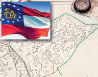
Georgia-Land Surveyors Package: 8 PDH
Original price was: $48.00.$40.00Current price is: $40.00. Add to cartThree Land Surveying courses courses that will earn 8 PDH guaranteed to be accepted by the Georgia State Board of Registration for Professional Engineers and Land Surveyors.Instructor: Raymond Bosek, PELand Surveyor’s Ethics: 2 PDH
In this ethics course the student will understand the standards of professional behavior for adherence to the highest ethical conduct and revisit the emphasis that the holder of a professional license has a direct and vital impact on the safety, health, and welfare of the public.
Airborne Topographic LiDAR: 3 PDH
In this course the student will review the principles of Airborne Topographic LiDAR and learn how to utilize methods to employ this technology in the field.
Construction Surveying Curves: 3 PDH
In this course the student will learns to locate points using angles and distances for establishing curves. An essential tool in construction surveying when determining the line of a curve for road layout or some other type of curved construction.
- Sale!
Idaho-Land Surveyors Package: 30 PDH
Original price was: $180.00.$90.00Current price is: $90.00. Add to cartEight Land Surveying courses courses that will earn 30 PDH guaranteed to be accepted by the Idaho Board of Licensure of Professional Engineers and Professional Land Surveyors. Instructor: Raymond Bosek, PELand Surveyor’s Ethics: 2 PDH
In this ethics course the student will understand the standards of professional behavior for adherence to the highest ethical conduct and revisit the emphasis that the holder of a professional license has a direct and vital impact on the safety, health, and welfare of the public.
Public Land Survey Rectangular System: 8 PDH
In this course the student will review the rectangular surveying system which has been used continuously in the United States since 1785. As all facets of this system occasionally come into use, the student will become well versed in the field procedures of conducting an original survey covering both historical and current methods.
Aerial Photogrammetry: 5 PDH
In this course the student will understand procedural guidance, technical specifications, and quality control (QC) criteria for performing aerial photogrammetric mapping activities.
Introduction to Small Unmanned Aircraft Systems (sUAS) for Land Surveyors: 4 PDH
This course is an introduction of using sUAS in land surveying. From FAA licensing requirements to common sUAS products and software, with an understanding of these basics a land surveyor can easily get started in using this up and coming technology.
Airborne Topographic LiDAR: 3 PDH
In this course the student will review the principles of Airborne Topographic LiDAR and learn how to utilize methods to employ this technology in the field.
Construction Surveying Curves: 3 PDH
In this course the student will learns to locate points using angles and distances for establishing curves. An essential tool in construction surveying when determining the line of a curve for road layout or some other type of curved construction.
Description of Lands: 3 PDH
This course provides guidance for documenting accurate boundary descriptions and locations by survey in the standards followed for Executive and public land orders and proclamations.
Corner Restoration Fundamentals: 2 PDH
In this course the student will understand the understand federal guidelines of resurveying corner monuments and the procedures and laws to successfully reestablish these boundaries.
Preview Course: Land Surveyor’s Ethics
Preview Course: Public Land Survey: Rectangular System
Preview Course: Aerial Photogrammetry
Preview Course: Introduction to Small Unmanned Aircraft Systems (sUAS) for Land Surveyors
Preview Course: Airborne Topographic LiDAR
Preview Course: Construction Surveying Curves
Preview Course: Description of Lands
Preview Course: Corner Restoration Fundamentals - Sale!

Illinois-Land Surveyors’s Package: 20 PDH
Original price was: $120.00.$70.00Current price is: $70.00. Add to cartThis course packages satisfies the Illinois continuing education requirements, (ref. ILAC 68/§ 1270.65)Two Land Surveying courses courses plus Illinois Statutes & Rules course, Sexual Harassment Prevention Training, and Land Surveyor Ethics that will earn 20 PDH guaranteed to be accepted by the Illinois Department of Financial and Professional Regulation. Instructor: Raymond Bosek, PE
-Four (4) hours in Statutes and Rules-Two (2) hours in professional conduct
-One (1) hour in sexual harassment prevention trainingIllinois – Statutes and Rules for Professional Land Surveyors: 4 PDH
In this course the student will study the State Board of Professional Land Surveyors of the Illinois Department of Financial and Professional Regulation Statutes and Rules. A ten (10) question quiz will test his or her understanding of the subject.
Land Surveyor’s Ethics: 2 PDH
In this ethics course the student will understand the standards of professional behavior for adherence to the highest ethical conduct and revisit the emphasis that the holder of a professional license has a direct and vital impact on the safety, health, and welfare of the public.
Public Land Survey: Rectangular System: 8 PDH
In this course the student will review the rectangular surveying system which has been used continuously in the United States since 1785. As all facets of this system occasionally come into use, the student will become well versed in the field procedures of conducting an original survey covering both historical and current methods.
Aerial Photogrammetry: 5 PDH
In this course the student will understand procedural guidance, technical specifications, and quality control (QC) criteria for performing aerial photogrammetric mapping activities..
Sexual Harassment Prevention Training: 1 PDH
In this course the student will understand what sexual harassment is, who it applies too, governing laws, and the methods for employers to address, correct , and prevent sexual harassment in the workplace.
- Sale!
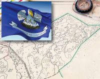
Louisiana-Land Surveyors’s Package: 8 PDH
Original price was: $48.00.$40.00Current price is: $40.00. Add to cartLouisiana CPD Approved Provider CPD.0000317This package satisfies the new LA rules effective Jan 1, 2017. Annually required 8 hrs, includes one required hour of Land Surveyor’s Ethics and the two required hour of Standards of Practice for Boundary Surveys, ref. §3105 (1)&(2)Three distance learning courses guaranteed to be accepted by the Louisiana Professional Engineering and Land Surveying Board Instructor: Raymond Bosek, PELand Surveyor’s Ethics: 2 PDH
This course satisfies the 1 required hour of professional ethics, ref. §3105(1)In this ethics course the student will understand the standards of professional behavior for adherence to the highest ethical conduct and revisit the emphasis that the holder of a professional license has a direct and vital impact on the safety, health, and welfare of the public.Louisiana–Standards of Practice for Boundary Surveys: 2 PDH
This course satisfies the two required hours of Standards of Practice for Boundary Surveys, ref. §3105 (2)In this course the student will review and examine the standards of practice for boundary surveys standards in Louisiana and satisfy the two required hours of continuing education required by the L.A.C. §3105 (2).Introduction to Small Unmanned Aircraft Systems (sUAS) for Land Surveyors : 4 PDH
This course is an introduction of using sUAS in land surveying. From FAA licensing requirements to common sUAS products and software, with an understanding of these basics a land surveyor can easily get started in using this up and coming technology.
- Sale!
Maine-Land Surveyors Package: 30 PDH
Original price was: $180.00.$90.00Current price is: $90.00. Add to cartEight Land Surveying courses courses that will earn 30 PDH guaranteed to be accepted by the Maine State Board of Licensure for Professional Engineers. Instructor: Raymond Bosek, PELand Surveyor’s Ethics: 2 PDH
In this ethics course the student will understand the standards of professional behavior for adherence to the highest ethical conduct and revisit the emphasis that the holder of a professional license has a direct and vital impact on the safety, health, and welfare of the public.
Public Land Survey Rectangular System: 8 PDH
In this course the student will review the rectangular surveying system which has been used continuously in the United States since 1785. As all facets of this system occasionally come into use, the student will become well versed in the field procedures of conducting an original survey covering both historical and current methods.
Aerial Photogrammetry: 5 PDH
In this course the student will understand procedural guidance, technical specifications, and quality control (QC) criteria for performing aerial photogrammetric mapping activities.
Introduction to Small Unmanned Aircraft Systems (sUAS) for Land Surveyors: 4 PDH
This course is an introduction of using sUAS in land surveying. From FAA licensing requirements to common sUAS products and software, with an understanding of these basics a land surveyor can easily get started in using this up and coming technology.
Airborne Topographic LiDAR: 3 PDH
In this course the student will review the principles of Airborne Topographic LiDAR and learn how to utilize methods to employ this technology in the field.
Construction Surveying Curves: 3 PDH
In this course the student will learns to locate points using angles and distances for establishing curves. An essential tool in construction surveying when determining the line of a curve for road layout or some other type of curved construction.
Description of Lands: 3 PDH
This course provides guidance for documenting accurate boundary descriptions and locations by survey in the standards followed for Executive and public land orders and proclamations.
Corner Restoration Fundamentals: 2 PDH
In this course the student will understand the understand federal guidelines of resurveying corner monuments and the procedures and laws to successfully reestablish these boundaries.
Preview Course: Land Surveyor’s Ethics
Preview Course: Public Land Survey: Rectangular System
Preview Course: Aerial Photogrammetry
Preview Course: Introduction to Small Unmanned Aircraft Systems (sUAS) for Land Surveyors
Preview Course: Airborne Topographic LiDAR
Preview Course: Construction Surveying Curves
Preview Course: Description of Lands
Preview Course: Corner Restoration Fundamentals - Sale!
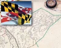
Maryland-Land Surveyors’s Package: 24 PDH
Original price was: $144.00.$80.00Current price is: $80.00. Add to cartMaryland Approved ProviderFive Land Surveying courses courses that will earn 24 PDH guaranteed to be accepted by the Maryland Board for Professional Land SurveyorsInstructor: Raymond Bosek, PEMaryland–Minimum Standards of Practice & Ethics: 4 PDH
This course satisfies the minimum 4 hours stds/ethics (ref. COMAR. §09.13.08.03)
In this course the student will review and examine both the minimum standards of practice for boundary surveys in Maryland as well Ethics to satisfy the four mandatory hours of continuing education required by the COMAR. §09.13.08.03.Public Land Survey: Rectangular System: 8 PDH
In this course the student will review the rectangular surveying system which has been used continuously in the United States since 1785. As all facets of this system occasionally come into use, the student will become well versed in the field procedures of conducting an original survey covering both historical and current methods.
Aerial Photogrammetry: 5 PDH
In this course the student will understand procedural guidance, technical specifications, and quality control (QC) criteria for performing aerial photogrammetric mapping activities.
Introduction to Small Unmanned Aircraft Systems (sUAS) for Land Surveyors : 4 PDH
This course is an introduction of using sUAS in land surveying. From FAA licensing requirements to common sUAS products and software, with an understanding of these basics a land surveyor can easily get started in using this up and coming technology.
Airborne Topographic LiDAR: 3 PDH
In this course the student will review the principles of Airborne Topographic LiDAR and learn how to utilize methods to employ this technology in the field.
- Sale!
Michigan-Land Surveyors Package: 30 PDH
Original price was: $180.00.$90.00Current price is: $90.00. Add to cartEight Land Surveying courses that will earn 30 PDH guaranteed to be accepted by the Michigan Department of Licensing and Regulatory Affairs.Instructor: Raymond Bosek, PELand Surveyor’s Ethics: 2 PDH
This course satisfies the Michigan continuing education requirement of two (2) professional development hours in engineering ethics, (ref. Michigan Administrative Code R339.16040)In this ethics course the student will understand the standards of professional behavior for adherence to the highest ethical conduct and revisit the emphasis that the holder of a professional license has a direct and vital impact on the safety, health, and welfare of the public.Public Land Survey Rectangular System: 8 PDH
In this course the student will review the rectangular surveying system which has been used continuously in the United States since 1785. As all facets of this system occasionally come into use, the student will become well versed in the field procedures of conducting an original survey covering both historical and current methods.
Aerial Photogrammetry: 5 PDH
In this course the student will understand procedural guidance, technical specifications, and quality control (QC) criteria for performing aerial photogrammetric mapping activities.
Introduction to Small Unmanned Aircraft Systems (sUAS) for Land Surveyors: 4 PDH
This course is an introduction of using sUAS in land surveying. From FAA licensing requirements to common sUAS products and software, with an understanding of these basics a land surveyor can easily get started in using this up and coming technology.
Airborne Topographic LiDAR: 3 PDH
In this course the student will review the principles of Airborne Topographic LiDAR and learn how to utilize methods to employ this technology in the field.
Construction Surveying Curves: 3 PDH
In this course the student will learns to locate points using angles and distances for establishing curves. An essential tool in construction surveying when determining the line of a curve for road layout or some other type of curved construction.
Description of Lands: 3 PDH
This course provides guidance for documenting accurate boundary descriptions and locations by survey in the standards followed for Executive and public land orders and proclamations.
Corner Restoration Fundamentals: 2 PDH
In this course the student will understand the understand federal guidelines of resurveying corner monuments and the procedures and laws to successfully reestablish these boundaries.
Preview Course: Land Surveyor’s Ethics
Preview Course: Public Land Survey: Rectangular System
Preview Course: Aerial Photogrammetry
Preview Course: Introduction to Small Unmanned Aircraft Systems (sUAS) for Land Surveyors
Preview Course: Airborne Topographic LiDAR
Preview Course: Construction Surveying Curves
Preview Course: Description of Lands
Preview Course: Corner Restoration Fundamentals - Sale!
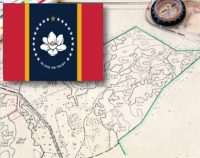
Mississippi-Land Surveyors’s Package: 12 PDH
Original price was: $72.00.$60.00Current price is: $60.00. Add to cartThis package satisfies all required hours including one required hour of ethics and the one required hour of standards of practice, ref. M.A.C. §Title 30, Part 901 Rule 23.1-3Five Land Surveying courses courses including Land Surveyor Ethics and Mississippi Standards of Practice that will earn 12 PDH guaranteed to be accepted by the Mississippi Board of Licensure for Professional Engineers and SurveyorsInstructor: Raymond Bosek, PELand Surveyor’s Ethics: 2 PDH
This course satisfies the 1 required hour of professional ethics, ref. M.A.C. §Title 30, Part 901 Rule 23.1-3.dIn this ethics course the student will understand the standards of professional behavior for adherence to the highest ethical conduct and revisit the emphasis that the holder of a professional license has a direct and vital impact on the safety, health, and welfare of the public.Mississippi–Standards of Practice for Land Surveyors: 1 PDH
This course satisfies the 1 required hour of standards of practice, ref. M.A.C. §Title 30, Part 901 Rule 23.1-3.eIn this course the student will review and examine the standards of practice for boundary surveys standards in Mississippi and satisfy the one hour of continuing education required by the M.A.C. §Title 30, Part 901 Rule 23.1 (3).Introduction to Small Unmanned Aircraft Systems (sUAS) for Land Surveyors : 4 PDH
This course is an introduction of using sUAS in land surveying. From FAA licensing requirements to common sUAS products and software, with an understanding of these basics a land surveyor can easily get started in using this up and coming technology.
Airborne Topographic LiDAR: 3 PDH
In this course the student will review the principles of Airborne Topographic LiDAR and learn how to utilize methods to employ this technology in the field.
Corner Restoration Fundamentals: 2 PDH
In this course the student will understand the understand federal guidelines of resurveying corner monuments and the procedures and laws to successfully reestablish these boundaries.
- Sale!
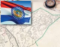
Missouri-Land Surveyors’s Package: 20 PDH
Original price was: $120.00.$70.00Current price is: $70.00. Add to cartFive Land Surveying courses courses that will earn 20 PDH guaranteed to be accepted by the Missouri Board for Architects, Professional Engineers, Professional Land Surveyors, and Landscape Architects.Instructor: Raymond Bosek, PEMissouri Surveying Standards: 2 PDH
This course satisfies the minimum 2 hours surveying standards (ref. 20 CSR 2030-8.020(1)(A))
In this course the student will review and examine the standards of practice for land surveying in Missouri.Land Surveyor’s Ethics: 2 PDH
In this ethics course the student will understand the standards of professional behavior for adherence to the highest ethical conduct and revisit the emphasis that the holder of a professional license has a direct and vital impact on the safety, health, and welfare of the public.
Public Land Survey: Rectangular System: 8 PDH
In this course the student will review the rectangular surveying system which has been used continuously in the United States since 1785. As all facets of this system occasionally come into use, the student will become well versed in the field procedures of conducting an original survey covering both historical and current methods.
Aerial Photogrammetry: 5 PDH
In this course the student will understand procedural guidance, technical specifications, and quality control (QC) criteria for performing aerial photogrammetric mapping activities.
Airborne Topographic LiDAR: 3 PDH
In this course the student will review the principles of Airborne Topographic LiDAR and learn how to utilize methods to employ this technology in the field.
- Sale!
Nevada-Land Surveyors Package: 30 PDH
Original price was: $180.00.$90.00Current price is: $90.00. Add to cartSix Land Surveying courses plus Nevada Ethics and Statutes & Codes course that will earn 30 PDH guaranteed to be accepted by the Nevada Board of Licensure of Professional Engineers and Professional Land Surveyors.Instructor: Raymond Bosek, PENevada – Ethics including NV Laws and Rules for Professional Engineers: 4 PDH
This course satisfies the Nevada continuing education requirement of two (2) professional development hours in professional ethics and one (1) professional development hour in provisions of NAC 625 & NRS 625, (ref. Nevada Administrative Code 625.40)In this course the student will study two ethics courses including the Nevada State Board of Professional Engineers and Land Surveyors Statutes and Codes. A total of thirty (30) questions will test his or her understanding of the subject.Public Land Survey Rectangular System: 8 PDH
In this course the student will review the rectangular surveying system which has been used continuously in the United States since 1785. As all facets of this system occasionally come into use, the student will become well versed in the field procedures of conducting an original survey covering both historical and current methods.
Aerial Photogrammetry: 5 PDH
In this course the student will understand procedural guidance, technical specifications, and quality control (QC) criteria for performing aerial photogrammetric mapping activities.
Introduction to Small Unmanned Aircraft Systems (sUAS) for Land Surveyors: 4 PDH
This course is an introduction of using sUAS in land surveying. From FAA licensing requirements to common sUAS products and software, with an understanding of these basics a land surveyor can easily get started in using this up and coming technology.
Airborne Topographic LiDAR: 3 PDH
In this course the student will review the principles of Airborne Topographic LiDAR and learn how to utilize methods to employ this technology in the field.
Construction Surveying Curves: 3 PDH
In this course the student will learns to locate points using angles and distances for establishing curves. An essential tool in construction surveying when determining the line of a curve for road layout or some other type of curved construction.
Description of Lands: 3 PDH
This course provides guidance for documenting accurate boundary descriptions and locations by survey in the standards followed for Executive and public land orders and proclamations.
Preview Course: Nevada Ethics, Statutes & Codes
Preview Course: Public Land Survey: Rectangular System
Preview Course: Aerial Photogrammetry
Preview Course: Introduction to Small Unmanned Aircraft Systems (sUAS) for Land Surveyors
Preview Course: Airborne Topographic LiDAR
Preview Course: Construction Surveying Curves
Preview Course: Description of Lands - Sale!
New Hampshire-Land Surveyors Package: 32 PDH
Original price was: $192.00.$90.00Current price is: $90.00. Add to cartNine Land Surveying courses courses that will earn 32 PDH (8 CEU) guaranteed to be accepted by the Instructor: Raymond Bosek, PELand Surveyor’s Ethics: 2 PDH
In this ethics course the student will understand the standards of professional behavior for adherence to the highest ethical conduct and revisit the emphasis that the holder of a professional license has a direct and vital impact on the safety, health, and welfare of the public.
Public Land Survey Rectangular System: 8 PDH
In this course the student will review the rectangular surveying system which has been used continuously in the United States since 1785. As all facets of this system occasionally come into use, the student will become well versed in the field procedures of conducting an original survey covering both historical and current methods.
Aerial Photogrammetry: 5 PDH
In this course the student will understand procedural guidance, technical specifications, and quality control (QC) criteria for performing aerial photogrammetric mapping activities.
Introduction to Small Unmanned Aircraft Systems (sUAS) for Land Surveyors: 4 PDH
This course is an introduction of using sUAS in land surveying. From FAA licensing requirements to common sUAS products and software, with an understanding of these basics a land surveyor can easily get started in using this up and coming technology.
Airborne Topographic LiDAR: 3 PDH
In this course the student will review the principles of Airborne Topographic LiDAR and learn how to utilize methods to employ this technology in the field.
Construction Surveying Curves: 3 PDH
In this course the student will learns to locate points using angles and distances for establishing curves. An essential tool in construction surveying when determining the line of a curve for road layout or some other type of curved construction.
Description of Lands: 3 PDH
This course provides guidance for documenting accurate boundary descriptions and locations by survey in the standards followed for Executive and public land orders and proclamations.
Corner Restoration Fundamentals: 2 PDH
In this course the student will understand the understand federal guidelines of resurveying corner monuments and the procedures and laws to successfully reestablish these boundaries.
Satellite Photogrammetry: 2 PDH
In this course the student will learn about satellite photogrammetry and its common applications. The student will review geo-positioning from satellite images and procedures for creating stereo pairs from satellite imagery as well as reviewing the top things to consider in buying optical satellite imagery.
Preview Course: Land Surveyor’s Ethics
Preview Course: Public Land Survey: Rectangular System
Preview Course: Aerial Photogrammetry
Preview Course: Introduction to Small Unmanned Aircraft Systems (sUAS) for Land Surveyors
Preview Course: Airborne Topographic LiDAR
Preview Course: Construction Surveying Curves
Preview Course: Description of Lands
Preview Course: Corner Restoration Fundamentals
Preview Course: Satellite Photogrammetry - Sale!
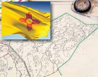
New Mexico-Land Surveyors’s Package: 30 PDH
Original price was: $180.00.$90.00Current price is: $90.00. Add to cartEight Land Surveying courses courses that will earn 30 PDH guaranteed to be accepted by the New Mexico State Board of Licensure for Professional Engineers and Professional SurveyorsInstructor: Raymond Bosek, PELand Surveyor’s Ethics: 2 PDH
In this ethics course the student will understand the standards of professional behavior for adherence to the highest ethical conduct and revisit the emphasis that the holder of a professional license has a direct and vital impact on the safety, health, and welfare of the public.
Public Land Survey: Rectangular System: 8 PDH
In this course the student will review the rectangular surveying system which has been used continuously in the United States since 1785. As all facets of this system occasionally come into use, the student will become well versed in the field procedures of conducting an original survey covering both historical and current methods.
Aerial Photogrammetry: 5 PDH
In this course the student will understand procedural guidance, technical specifications, and quality control (QC) criteria for performing aerial photogrammetric mapping activities.
Introduction to Small Unmanned Aircraft Systems (sUAS) for Land Surveyors : 4 PDH
This course is an introduction of using sUAS in land surveying. From FAA licensing requirements to common sUAS products and software, with an understanding of these basics a land surveyor can easily get started in using this up and coming technology.
Airborne Topographic LiDAR: 3 PDH
In this course the student will review the principles of Airborne Topographic LiDAR and learn how to utilize methods to employ this technology in the field.
Construction Surveying Curves: 3 PDH
In this course the student will learns to locate points using angles and distances for establishing curves. An essential tool in construction surveying when determining the line of a curve for road layout or some other type of curved construction.
Description of Lands: 3 PDH
This course provides guidance for documenting accurate boundary descriptions and locations by survey in the standards followed for Executive and public land orders and proclamations.
Corner Restoration Fundamentals: 2 PDH
In this course the student will learn about satellite photogrammetry and its commom applications. The student will review geo-positioning from satellite images and procedures for creating stereo pairs from satellite imagery as well as reviewing the top things to consider in buying optical satellite imagery.
Preview Course: Land Surveyor’s Ethics
Preview Course: Public Land Survey: Rectangular System
Preview Course: Aerial Photogrammetry
Preview Course: Introduction to Small Unmanned Aircraft Systems (sUAS) for Land Surveyors
Preview Course: Airborne Topographic LiDAR
Preview Course: Construction Surveying Curves
Preview Course: Description of Lands
Preview Course: Corner Restoration Fundamentals - Sale!
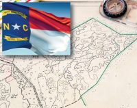
North Carolina-Land Surveyors’s Package: 15 PDH
Original price was: $90.00.$60.00Current price is: $60.00. Add to cartNorth Carolina Approved Sponsor No: S-0650Five Land Surveying courses courses that will earn 15 PDH guaranteed to be accepted by the North Carolina Board of Examiners for Engineers and SurveyorsInstructor: Raymond Bosek, PENorth Carolina–Standards of Practice for Land Surveying: 1 PDH
In this course the student will review and examine the standards of practice for land surveying in North Carolina and satisfy the one hour of continuing education required by the 21 NCAC 56.1703.
Land Surveyor’s Ethics: 2 PDH
In this ethics course the student will understand the standards of professional behavior for adherence to the highest ethical conduct and revisit the emphasis that the holder of a professional license has a direct and vital impact on the safety, health, and welfare of the public.
Introduction to Small Unmanned Aircraft Systems (sUAS) for Land Surveyors : 4 PDH
This course is an introduction of using sUAS in land surveying. From FAA licensing requirements to common sUAS products and software, with an understanding of these basics a land surveyor can easily get started in using this up and coming technology.
Airborne Topographic LiDAR: 3 PDH
In this course the student will review the principles of Airborne Topographic LiDAR and learn how to utilize methods to employ this technology in the field.
Construction Surveying Curves: 3 PDH
In this course the student will learns to locate points using angles and distances for establishing curves. An essential tool in construction surveying when determining the line of a curve for road layout or some other type of curved construction.
Corner Restoration Fundamentals: 2 PDH
This course provides guidance for documenting accurate boundary descriptions and locations by survey in the standards followed for Executive and public land orders and proclamations.
Preview Course: North Carolina–Standards of Practice for Land Surveying
Preview Course: Land Surveyor’s Ethics
Preview Course: Introduction to Small Unmanned Aircraft Systems (sUAS) for Land Surveyors
Preview Course: Airborne Topographic LiDAR
Preview Course: Construction Surveying Curves
Preview Course: Corner Restoration Fundamentals - Sale!
North Dakota-Land Surveyors Package: 30 PDH
Original price was: $180.00.$90.00Current price is: $90.00. Add to cartEight Land Surveying courses courses that will earn 30 PDH guaranteed to be accepted by the North Dakota State Board of Registration for Professional Engineers & Land Surveyors.Instructor: Raymond Bosek, PELand Surveyor’s Ethics: 2 PDH
In this ethics course the student will understand the standards of professional behavior for adherence to the highest ethical conduct and revisit the emphasis that the holder of a professional license has a direct and vital impact on the safety, health, and welfare of the public.
Public Land Survey Rectangular System: 8 PDH
In this course the student will review the rectangular surveying system which has been used continuously in the United States since 1785. As all facets of this system occasionally come into use, the student will become well versed in the field procedures of conducting an original survey covering both historical and current methods.
Aerial Photogrammetry: 5 PDH
In this course the student will understand procedural guidance, technical specifications, and quality control (QC) criteria for performing aerial photogrammetric mapping activities.
Introduction to Small Unmanned Aircraft Systems (sUAS) for Land Surveyors: 4 PDH
This course is an introduction of using sUAS in land surveying. From FAA licensing requirements to common sUAS products and software, with an understanding of these basics a land surveyor can easily get started in using this up and coming technology.
Airborne Topographic LiDAR: 3 PDH
In this course the student will review the principles of Airborne Topographic LiDAR and learn how to utilize methods to employ this technology in the field.
Construction Surveying Curves: 3 PDH
In this course the student will learns to locate points using angles and distances for establishing curves. An essential tool in construction surveying when determining the line of a curve for road layout or some other type of curved construction.
Description of Lands: 3 PDH
This course provides guidance for documenting accurate boundary descriptions and locations by survey in the standards followed for Executive and public land orders and proclamations.
Corner Restoration Fundamentals: 2 PDH
In this course the student will understand the understand federal guidelines of resurveying corner monuments and the procedures and laws to successfully reestablish these boundaries.
Preview Course: Land Surveyor’s Ethics
Preview Course: Public Land Survey: Rectangular System
Preview Course: Aerial Photogrammetry
Preview Course: Introduction to Small Unmanned Aircraft Systems (sUAS) for Land Surveyors
Preview Course: Airborne Topographic LiDAR
Preview Course: Construction Surveying Curves
Preview Course: Description of Lands
Preview Course: Corner Restoration Fundamentals


Shopping Cart