
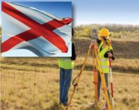
Alabama–Standards of Practice for Land Surveying: 4 PDH
$24.00
SPECIFIC KNOWLEDGE OR SKILL OBTAINED
This course teaches the following specific knowledge and skills:
- Explain the standards of practice for boundary surveys in Alabama
- Understand the reasons for and why
- Discuss the final products of a properly performed survey
- Discuss accuracy and tolerance requirements
CERTIFICATE OF COMPLETION
You will be able to immediately print a certificate of completion after passing a ten (10) question multiple-choice quiz. The quiz can be retaken unlimited times until a passing grade of 70% or better is earned. This course satisfies four (4) professional development hours (PDH) of continuing education.
Click “Preview Course” to View Prior to Purchase
Click “Add to Cart” to Purchase and Access Quiz
Related Courses
Louisiana–Standards of Practice for Boundary Surveys: 2 PDH
$12.00 Add to cartIn this course the student will review and examine the standards of practice for boundary surveys standards in Louisiana and satisfy the two required hours of continuing education required by the L.A.C. §3105 (2).Instructor: Raymond Bosek, PESPECIFIC KNOWLEDGE OR SKILL OBTAINED
This course teaches the following specific knowledge and skills:
- Explain the standards of practice for boundary surveys in Louisiana
- Understand the reasons for and why
- Discuss the final products of a properly performed survey
- Discuss accuracy and tolerance requirements
CERTIFICATE OF COMPLETION
You will be able to immediately print a certificate of completion after passing a 20 question multiple-choice quiz. The quiz can be retaken unlimited times until a passing grade of 70% or better is earned. This course satisfies three professional development hours (PDH) of continuing education.
Preview CourseClick “Preview Course” to View Prior to PurchaseClick “Add to Cart” to Purchase and Access Quiz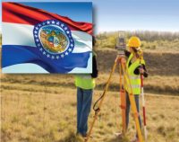
Missouri Surveying Standards: 2 PDH
$12.00 Add to cartIn this course the student will review and examine the standards of practice for land surveying in Missouri and satisfy the two (2) hours of continuing education required by Missouri Code of State Regulations 20 CSR 2030-8.020(1)(A).Instructor: Raymond Bosek, PESPECIFIC KNOWLEDGE OR SKILL OBTAINED
This course teaches the following specific knowledge and skills:
- Explain the standards of practice for boundary surveys in Missouri
- Understand the reasons for and why
- Discuss the final products of a properly performed survey
- Discuss accuracy and tolerance requirements
CERTIFICATE OF COMPLETION
You will be able to immediately print a certificate of completion after passing a ten (10) question multiple-choice quiz. The quiz can be retaken unlimited times until a passing grade of 70% or better is earned. This course satisfies two (2) professional development hours (PDH) of continuing education.
Preview CourseClick “Preview Course” to View Prior to PurchaseClick “Add to Cart” to Purchase and Access Quiz

