

Illinois – Statutes and Rules for Professional Land Surveyors: 4 PDH
$24.00
SPECIFIC KNOWLEDGE OR SKILL OBTAINED
This course teaches the following specific knowledge and skills:
- The land surveyor’s guidelines for practicing within Illinois's statutes and rules
- Explain the standards of practice for boundary surveys in Louisiana
- Understand the reasons for and why
- Discuss the final products of a properly performed survey
- Discuss accuracy and tolerance requirements
- The and surveyor’s responsibility to the profession
CERTIFICATE OF COMPLETION
You will be able to immediately print a certificate of completion after passing a ten (10) question multiple-choice quiz. The quiz can be retaken unlimited times until a passing grade of 70% or better is earned. This course satisfies four (4) professional development hours (PDH) of continuing education.
Related Courses
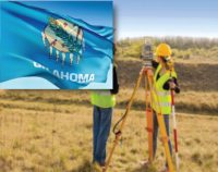
Oklahoma Minimum Standards for the Practice of Land Surveying: 2 PDH
$12.00 Add to cartIn this course the student will review and examine with the standards of practice for land surveying in Oklahoma and satisfy the two hours of continuing education required by the O.A.C. §245:15-11-5.Instructor: Raymond Bosek, PESPECIFIC KNOWLEDGE OR SKILL OBTAINED
This course teaches the following specific knowledge and skills:
- Explain the standards of practice for boundary surveys in Oklahoma
- Understand the reasons for and why
- Discuss the final products of a properly performed survey
- Discuss accuracy and tolerance requirements
CERTIFICATE OF COMPLETION
You will be able to immediately print a certificate of completion after passing a ten (10) question multiple-choice quiz. The quiz can be retaken unlimited times until a passing grade of 70% or better is earned. This course satisfies two (2) professional development hours (PDH) of continuing education.
Preview CourseClick “Preview Course” to View Prior to PurchaseClick “Add to Cart” to Purchase and Access Quiz- Sale!

Illinois-Land Surveyors’s Package: 20 PDH
Original price was: $120.00.$70.00Current price is: $70.00. Add to cartThis course packages satisfies the Illinois continuing education requirements, (ref. ILAC 68/§ 1270.65)Two Land Surveying courses courses plus Illinois Statutes & Rules course, Sexual Harassment Prevention Training, and Land Surveyor Ethics that will earn 20 PDH guaranteed to be accepted by the Illinois Department of Financial and Professional Regulation. Instructor: Raymond Bosek, PE
-Four (4) hours in Statutes and Rules-Two (2) hours in professional conduct
-One (1) hour in sexual harassment prevention trainingIllinois – Statutes and Rules for Professional Land Surveyors: 4 PDH
In this course the student will study the State Board of Professional Land Surveyors of the Illinois Department of Financial and Professional Regulation Statutes and Rules. A ten (10) question quiz will test his or her understanding of the subject.
Land Surveyor’s Ethics: 2 PDH
In this ethics course the student will understand the standards of professional behavior for adherence to the highest ethical conduct and revisit the emphasis that the holder of a professional license has a direct and vital impact on the safety, health, and welfare of the public.
Public Land Survey: Rectangular System: 8 PDH
In this course the student will review the rectangular surveying system which has been used continuously in the United States since 1785. As all facets of this system occasionally come into use, the student will become well versed in the field procedures of conducting an original survey covering both historical and current methods.
Aerial Photogrammetry: 5 PDH
In this course the student will understand procedural guidance, technical specifications, and quality control (QC) criteria for performing aerial photogrammetric mapping activities..
Sexual Harassment Prevention Training: 1 PDH
In this course the student will understand what sexual harassment is, who it applies too, governing laws, and the methods for employers to address, correct , and prevent sexual harassment in the workplace.

