
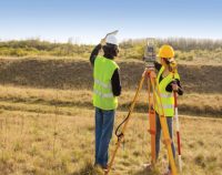
Louisiana – Standards of Practice for Boundary Surveys: 2 PDH
$12.00
SPECIFIC KNOWLEDGE OR SKILL OBTAINED
This course teaches the following specific knowledge and skills:
- Explain the standards of practice for boundary surveys in Louisiana
- Understand the reasons for and why
- Discuss the final products of a properly performed survey
- Discuss accuracy and tolerance requirements
CERTIFICATE OF COMPLETION
You will be able to immediately print a certificate of completion after passing a 20 question multiple-choice quiz. The quiz can be retaken unlimited times until a passing grade of 70% or better is earned. This course satisfies three professional development hours (PDH) of continuing education.
Related Courses
- Sale!
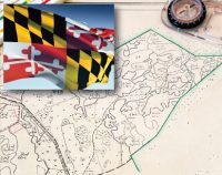
Maryland-Land Surveyors’s Package: 24 PDH
Original price was: $144.00.$80.00Current price is: $80.00. Add to cartMaryland Approved ProviderFive Land Surveying courses courses that will earn 24 PDH guaranteed to be accepted by the Maryland Board for Professional Land SurveyorsInstructor: Raymond Bosek, PEMaryland–Minimum Standards of Practice & Ethics: 4 PDH
This course satisfies the minimum 4 hours stds/ethics (ref. COMAR. §09.13.08.03)
In this course the student will review and examine both the minimum standards of practice for boundary surveys in Maryland as well Ethics to satisfy the four mandatory hours of continuing education required by the COMAR. §09.13.08.03.Public Land Survey: Rectangular System: 8 PDH
In this course the student will review the rectangular surveying system which has been used continuously in the United States since 1785. As all facets of this system occasionally come into use, the student will become well versed in the field procedures of conducting an original survey covering both historical and current methods.
Aerial Photogrammetry: 5 PDH
In this course the student will understand procedural guidance, technical specifications, and quality control (QC) criteria for performing aerial photogrammetric mapping activities.
Introduction to Small Unmanned Aircraft Systems (sUAS) for Land Surveyors : 4 PDH
This course is an introduction of using sUAS in land surveying. From FAA licensing requirements to common sUAS products and software, with an understanding of these basics a land surveyor can easily get started in using this up and coming technology.
Airborne Topographic LiDAR: 3 PDH
In this course the student will review the principles of Airborne Topographic LiDAR and learn how to utilize methods to employ this technology in the field.
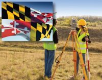
Maryland–Minimum Standards of Practice & Ethics: 4 PDH
$24.00 Add to cartIn this course the student will review and examine both the minimum standards of practice for boundary surveys in Maryland as well Ethics to satisfy the four mandatory hours of continuing education required by the COMAR. §09.13.08.03.Instructor: Raymond Bosek, PESPECIFIC KNOWLEDGE OR SKILL OBTAINED
This course teaches the following specific knowledge and skills:
- Explain the standards of practice for boundary surveys in Maryland
- Understand the reasons for and why
- Discuss the final products of a properly performed survey
- Discuss accuracy and tolerance requirements
- Describe the value of being a Professional and discuss the various aspects of professionalism
- Understand the responsibilities of being a professional land surveyor
- Discuss ethical principles and codes of conduct including the land surveyor’s ethics creed and cannons
- Discuss the nine aspects of the principles of land surveyor ethics
CERTIFICATE OF COMPLETION
You will be able to immediately print a certificate of completion after passing a 20 question multiple-choice quiz. The quiz can be retaken unlimited times until a passing grade of 70% or better is earned. This course satisfies four (4) professional development hours (PDH) of continuing education.
Preview CourseClick “Preview Course” to View Prior to PurchaseClick “Add to Cart” to Purchase and Access Quiz

