
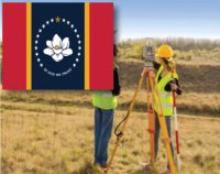
Mississippi–Standards of Practice for Land Surveyors: 1 PDH
$6.00
SPECIFIC KNOWLEDGE OR SKILL OBTAINED
This course teaches the following specific knowledge and skills:
- Explain the standards of practice for boundary surveys in Mississippi
- Understand the reasons for and why
- Discuss the final products of a properly performed survey
- Discuss accuracy and tolerance requirements
CERTIFICATE OF COMPLETION
You will be able to immediately print a certificate of completion after passing a 10 question multiple-choice quiz. The quiz can be retaken unlimited times until a passing grade of 70% or better is earned. This course satisfies three professional development hours (PDH) of continuing education.
Related Courses
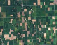
Public Land Survey: Rectangular System: 8 PDH
$40.00 Add to cartIn this course the student will review the rectangular surveying system which has been used continuously in the United States since 1785. As all facets of this system occasionally come into use, the student will become well versed in the field procedures of conducting an original survey covering both historical and current methods.Instructor: Raymond Bosek, PESPECIFIC KNOWLEDGE OR SKILL OBTAINED
This course teaches the following specific knowledge and skills:
- Explain the general scheme of the rectangular system: points, meridian, base lines, parallels, etc.
- Understand township boundaries
- Discuss subdivision of townships
- Discuss extension and completion surveys
- Explain methods of section subdivision
- Discuss protraction diagrams and developing amended diagrams
- Explain methods of surveying amended protraction diagrams
- Discuss meandering & swamp/overflowed lands
- Discuss limits of closure for original survey & soil classification
- Understand legal settings of Ordinary High Water Mark (OHWM)
CERTIFICATE OF COMPLETION
You will be able to immediately print a certificate of completion after passing a 25 question multiple-choice quiz. The quiz can be retaken unlimited times until a passing grade of 70% or better is earned. This course satisfies eight professional development hours (PDH) of continuing education.
Preview CourseClick “Preview Course” to View Prior to PurchaseClick “Add to Cart” to Purchase and Access Quiz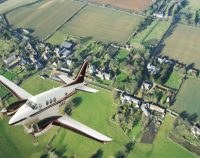
Aerial Photogrammetry: 5 PDH
$30.00 Add to cartIn this course the student will understand procedural guidance, technical specifications, and quality control (QC) criteria for performing aerial photogrammetric mapping activities.Instructor: Raymond Bosek, PESPECIFIC KNOWLEDGE OR SKILL OBTAINED
This course teaches the following specific knowledge and skills:
- Discuss the fundamentals & principles of aerial photogrammetry
- Explain photographic scale, geometry and coordinate system equations
- Discuss operational procedures and standards
- Discuss all aspects of planning
- Explain aerial image acquisition & aerial triangulation
- Understand digital photogrammetric mapping workflow
CERTIFICATE OF COMPLETION
You will be able to immediately print a certificate of completion after passing a 20 question multiple-choice quiz. The quiz can be retaken unlimited times until a passing grade of 70% or better is earned. This course satisfies five professional development hours (PDH) of continuing education.
Preview CourseClick “Preview Course” to View Prior to PurchaseClick “Add to Cart” to Purchase and Access Quiz

