

North Carolina-Land Surveyors’s Package: 15 PDH
Original price was: $90.00.$60.00Current price is: $60.00.
North Carolina–Standards of Practice for Land Surveying: 1 PDH
In this course the student will review and examine the standards of practice for land surveying in North Carolina and satisfy the one hour of continuing education required by the 21 NCAC 56.1703.
Land Surveyor’s Ethics: 2 PDH
In this ethics course the student will understand the standards of professional behavior for adherence to the highest ethical conduct and revisit the emphasis that the holder of a professional license has a direct and vital impact on the safety, health, and welfare of the public.
Introduction to Small Unmanned Aircraft Systems (sUAS) for Land Surveyors : 4 PDH
This course is an introduction of using sUAS in land surveying. From FAA licensing requirements to common sUAS products and software, with an understanding of these basics a land surveyor can easily get started in using this up and coming technology.
Airborne Topographic LiDAR: 3 PDH
In this course the student will review the principles of Airborne Topographic LiDAR and learn how to utilize methods to employ this technology in the field.
Construction Surveying Curves: 3 PDH
In this course the student will learns to locate points using angles and distances for establishing curves. An essential tool in construction surveying when determining the line of a curve for road layout or some other type of curved construction.
Corner Restoration Fundamentals: 2 PDH
This course provides guidance for documenting accurate boundary descriptions and locations by survey in the standards followed for Executive and public land orders and proclamations.
Preview Course: North Carolina–Standards of Practice for Land Surveying
Preview Course: Land Surveyor’s Ethics
Preview Course: Introduction to Small Unmanned Aircraft Systems (sUAS) for Land Surveyors
Preview Course: Airborne Topographic LiDAR
Preview Course: Construction Surveying Curves
Preview Course: Corner Restoration Fundamentals
Related Courses
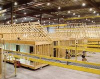
Advanced Fabricated Building: 6 PDH
$36.00 Add to cartIn this course the student will understand the building requirements of manufactured structures, particularly residential homes in Florida, as well as understand the various fabrication materials used for other advanced building projects. Instructor: Raymond Bosek, PESPECIFIC KNOWLEDGE OR SKILL OBTAINED
This course teaches the following specific knowledge and skills:
- Discuss building codes & HUD codes for fabricated structures
- Understand the materials & products of manufactured buildings
- Discuss systems & systems testing of manufactured buildings
- Explain the various fabrication products for advanced construction
- Discuss the benefits and drawbacks of each of these fabrication products
CERTIFICATE OF COMPLETION
You will be able to immediately print a certificate of completion after passing a 20 question multiple-choice quiz. The quiz can be retaken unlimited times until a passing grade of 70% or better is earned. This course satisfies six professional development hours (PDH) of continuing education.
Preview CourseClick “Preview Course” to View Prior to PurchaseClick “Add to Cart” to Purchase and Access Quiz- Sale!

Louisiana-Civil Engineering Package: 30 PDH
Original price was: $180.00.$90.00Current price is: $90.00. Add to cartLouisiana CPD Approved Provider CPD.0000317This course satisfies the new LA rules effective Jan 1, 2017, includes four required hours of Life Safety Code, building codes and/or Americans with Disabilities Act Accessibility Guidelines and the one required hour of professional ethics, ref. §3105Five Civil Engineering courses plus Louisiana Laws, Rules, & Ethics and Life Safety Code that will earn 30 PDH accepted by the Louisiana Professional Engineering and Land Surveying Board Instructor: Raymond Bosek, PELouisiana – Laws, Rules, and Ethics for Professional Engineers: 3 PDH
Satisfies 1 hr Ethics
In this course the student will study the Louisiana Board of Professional Engineering and Land Surveying Board (lapels) Laws & Rules including Professional Engineering Ethics.Accident and Operational Safety Analysis: 4 PDH
Satisfies 4 hrs Life Safety Code
In this course the student will understand the fundamental concepts of accident dynamics, accident prevention, and accident analysis. The student will learn the theoretical bases of safety management and accident analysis, and the practical application of a Safety Management framework for an organization.Bridge Steels and their Mechanical Properties: 4 PDH
In this course the student will gain a comprehensive understanding of the types, properties, manufacturing processes, and performance characteristics of structural steels used in bridge construction. They will understand how various steel grades are selected based on mechanical properties, environmental conditions, and fabrication needs.
Continuously Reinforced Concrete Pavement: 5 PDH
In this course the student will understand the design, construction, maintenance, and rehabilitation of Continuously Reinforced Concrete Pavement (CRCP). They will grasp the critical principles governing CRCP performance, including crack control, reinforcement detailing, and the role of materials and environmental conditions in long-term pavement behavior.
Corrosion Protection of Steel Bridges: 5 PDH
In this course the student will understand the principles, materials, environmental factors, and design strategies necessary to mitigate corrosion in steel bridge structures. They will develop a comprehensive knowledge of corrosion mechanisms, protection systems, and performance evaluation.
Curing of Portland Cement Concrete Pavements: 4 PDH
In this course the student will gain detailed, research-based guidance on the curing process for concrete pavements, including pre-construction planning, methods of curing (initial and final), material selection, environmental considerations, and techniques to verify curing effectiveness. It emphasizes best practices to ensure long-term pavement performance and reduce early-life concrete distress.
Roller-Compacted Concrete : 5 PDH
In this course the student will understand the principles, methods, and considerations involved in the use of roller-compacted concrete (RCC) for civil works structures, particularly dams. They will gain foundational knowledge of material properties, mix design, construction techniques, and quality assurance protocols essential to RCC implementation.
XXXXXXXXXXXXXXXXXXX
Preview Course: Louisiana Laws, Rules and Ethics
Preview Course: Accident and Operational Safety Analysis
Preview Course: Bridge Steels
Preview Course: Continuously Reinforced Concrete Pavement
Preview Course: Corrosion Protection of Steel Bridges
Preview Course: Curing of PCC Pavements
Preview Course: Roller-Compacted Concrete

