
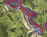
Remote Sensing Essentials: 5 PDH
$30.00
SPECIFIC KNOWLEDGE OR SKILL OBTAINED
This course teaches the following specific knowledge and skills:
- Explain remote sensing and its applications
- Discuss the basic components of remote sensing
- Discuss the history and future of remote sensing
- Understand three-dimensional (3d) data acquisition
- Describe elements of processing geospatial data
- Explain image enhancements
- Explain Digital Elevation Models (DEMs)
CERTIFICATE OF COMPLETION
You will be able to immediately print a certificate of completion after passing a 20 question multiple-choice quiz. The quiz can be retaken unlimited times until a passing grade of 70% or better is earned. This course satisfies five (5) hours of professional development (PDH).
Related Courses

Roundabouts Part 2: 5 PDH
$30.00 Add to cartThis is part II of a three-part series. The second course covering chapters 3, 4, & 5 of Roundabouts: An Informational Guide from the Federal Highway Administration. This course provides an in-depth look into planning a roundabout and what factors to account for when designing it. Also, it covers what is necessary to operate a successful roundabout and the cause and effect of different features. Last, you will understand the differences in safety between roundabouts and signalized intersections.Instructor: Raymond Bosek, PEThis is part II of a three-part series. The second course covering chapters 3, 4, & 5 of Roundabouts: An Informational Guide from the Federal Highway Administration. This course provides an in-depth look into planning a roundabout and what factors to account for when designing it. Also, it covers what is necessary to operate a successful roundabout and the cause and effect of different features. Last, you will understand the differences in safety between roundabouts and signalized intersections.
SPECIFIC KNOWLEDGE OR SKILL OBTAINED
This course teaches the following specific knowledge and skills:
- Planning and design of roundabouts
- Comparing operational performance
- Space and economic evaluations
- Traffic operations
- Performance Analysis
- Safety and statistics
- Crash prediction models
CERTIFICATE OF COMPLETION
You will be able to immediately print a certificate of completion after passing a 30 question multiple-choice quiz. The quiz can be retaken unlimited times until a passing grade of 70% or better is earned. This course satisfies five (5) continuing education hour (CEH)/professional development hour (PDH) of continuing education.
Preview CourseClick “Preview Course” to View Prior to PurchaseClick “Add to Cart” to Purchase and Access Quiz
Stream Hydraulics: 3 PDH
$18.00 Add to cartIn this online course a student will understand the essentials of stream hydraulics and the various formulas and calculations available to solve problems associated with streams.Instructor: Raymond Bosek, PESPECIFIC KNOWLEDGE OR SKILL OBTAINED
This course teaches the following specific knowledge and skills:
- Understand channel cross-section parameters: flow depth, hydraulic depth, and hydraulic radius
- Discuss the dimensionless numbers
- Understand the continuity equation, Bernoulli equation and conservation of momentum equations
- Explain hydraulic calculations for uniform flow in a stream
- Explain the use of weirs for flow measurement
- Discuss channel routing procedures
CERTIFICATE OF COMPLETION
You will be able to immediately print a certificate of completion after passing a fifteen (15) question multiple-choice quiz. The quiz can be retaken unlimited times until a passing grade of 70% or better is earned. This course satisfies three (3) continuing education hour (CEH)/professional development hour (PDH) of continuing education.
Preview CourseClick” Preview Course” to View Prior to PurchaseClick “Add to Cart” to Purchase and Access Quiz

