
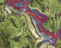
Remote Sensing Essentials: 5 PDH
$30.00
SPECIFIC KNOWLEDGE OR SKILL OBTAINED
This course teaches the following specific knowledge and skills:
- Explain remote sensing and its applications
- Discuss the basic components of remote sensing
- Discuss the history and future of remote sensing
- Understand three-dimensional (3d) data acquisition
- Describe elements of processing geospatial data
- Explain image enhancements
- Explain Digital Elevation Models (DEMs)
CERTIFICATE OF COMPLETION
You will be able to immediately print a certificate of completion after passing a 20 question multiple-choice quiz. The quiz can be retaken unlimited times until a passing grade of 70% or better is earned. This course satisfies five (5) hours of professional development (PDH).
Related Courses
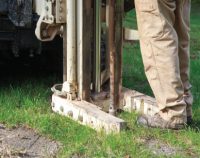
Geotechnical Subsurface Exploration for Roadways: 5 PDH
$30.00 Add to cartIn this course the student will understand the essentials of subsurface explorations for roadways with a comprehensive overview including site preparation, sampling methods, types of testing and methods, as well as standard guidelines and recommendations.Instructor: Raymond Bosek, PESPECIFIC KNOWLEDGE OR SKILL OBTAINED
This course teaches the following specific knowledge and skills:
- Discuss preparing for subsurface explorations
- Explain field reconnaissance and setting-up a exploration program
- Discuss sampling techniques and tools
- Explain various tests in addition to the standard penetration test (SPT)
- Understand guidelines for minimum exploration
CERTIFICATE OF COMPLETION
You will be able to immediately print a certificate of completion after passing a 20 question multiple-choice quiz. The quiz can be retaken unlimited times until a passing grade of 70% or better is earned. This course satisfies five (5) hours of professional development (PDH).
Preview CourseClick “Preview Course” to view prior to purchaseClick “Add to Cart” to purchase
Strategies for Improving Sustainability of Asphalt Pavements: 3 PDH
$18.00 Add to cartIn this course the student will understand sustainability throughout the entire pavement life cycle and the importance of recognizing context sensitivity and assessing trade-offs in developing sustainable solutions.Instructor: Raymond Bosek, PESPECIFIC KNOWLEDGE OR SKILL OBTAINED
This course teaches the following specific knowledge and skills:
- Explain selection, design, and production of asphalt materials for sustainability
- Discuss sustainable strategies in asphalt pavement design and construction
- Understand sustainable concepts on preservation/maintenance of asphalt pavements
- Explain asphalt pavement end of life sustainable strategies
CERTIFICATE OF COMPLETION
You will be able to immediately print a certificate of completion after passing a 15 question multiple-choice quiz. The quiz can be retaken unlimited times until a passing grade of 70% or better is earned. This course satisfies three (3) hours of professional development (PDH).
Preview CourseClick “Preview Course” to view prior to purchaseClick “Add to Cart” to purchase

