
Satellite Photogrammetry: 2 PDH
$12.00
SPECIFIC KNOWLEDGE OR SKILL OBTAINED
This course teaches the following specific knowledge and skills:
- Explain the characteristics of the most popular high- and medium-resolution commercial imaging satellites
- Discuss planimetric, classification, and topographic mapping
- Discuss geo-positioning and convergence angles
- Discuss what to consider in buying optical satellite imagery
CERTIFICATE OF COMPLETION
You will be able to immediately print a certificate of completion after passing a 10 question multiple-choice quiz. The quiz can be retaken unlimited times until a passing grade of 70% or better is earned. This course satisfies two professional development hours (PDH) of continuing education.
Related Courses

Aerial Photogrammetry: 5 PDH
$30.00 Add to cartIn this course the student will understand procedural guidance, technical specifications, and quality control (QC) criteria for performing aerial photogrammetric mapping activities.Instructor: Raymond Bosek, PESPECIFIC KNOWLEDGE OR SKILL OBTAINED
This course teaches the following specific knowledge and skills:
- Discuss the fundamentals & principles of aerial photogrammetry
- Explain photographic scale, geometry and coordinate system equations
- Discuss operational procedures and standards
- Discuss all aspects of planning
- Explain aerial image acquisition & aerial triangulation
- Understand digital photogrammetric mapping workflow
CERTIFICATE OF COMPLETION
You will be able to immediately print a certificate of completion after passing a 20 question multiple-choice quiz. The quiz can be retaken unlimited times until a passing grade of 70% or better is earned. This course satisfies five professional development hours (PDH) of continuing education.
Preview CourseClick “Preview Course” to View Prior to PurchaseClick “Add to Cart” to Purchase and Access Quiz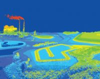
Airborne Topographic LiDAR: 3 PDH
$18.00 Add to cartIn this course the student will review the principles of Airborne Topographic LiDAR and learn how to utilize methods to employ this technology in the field.Instructor: Raymond Bosek, PESPECIFIC KNOWLEDGE OR SKILL OBTAINED
This course teaches the following specific knowledge and skills:
- Explain what Airborne Topographic LiDAR is
- Understand the principles and methods of operation
- Discuss overall planning concepts
- Discuss LiDAR data processing and report generation
CERTIFICATE OF COMPLETION
You will be able to immediately print a certificate of completion after passing a 10 question multiple-choice quiz. The quiz can be retaken unlimited times until a passing grade of 70% or better is earned. This course satisfies three professional development hours (PDH) of continuing education.
Preview CourseClick “Preview Course” to View Prior to PurchaseClick “Add to Cart” to Purchase and Access Quiz

